


 Park Avenue
231 meters
St John's Grove
276 meters
Redcar Bus Station
468 meters
Zetland Park
509 meters
Brooksbank Avenue
517 meters
Zetland Park
534 meters
High Street
574 meters
Central Station
578 meters
Just a basic train station. The station is getting a revamp at present. You have a ti... Redcar East Station-Borough Road
585 meters
Fairly basic railway station with limited seating and shelter on the platforms. There... Lilac Grove
588 meters
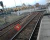
Redcar East
614 meters
Updated Shelters in both directions are an improvement, but ticket machine only avail... Central Station
641 meters
Just a basic train station. The station is getting a revamp at present. You have a ti... Sandringham Road
643 meters
Regent Walk
649 meters
The Yorkshire Coble
709 meters
Local bar selling local lagers! Pub full of regulars! But friendly enough for outside... The Yorkshire Coble
755 meters
Local bar selling local lagers! Pub full of regulars! But friendly enough for outside... Clock
794 meters
Park Avenue
231 meters
St John's Grove
276 meters
Redcar Bus Station
468 meters
Zetland Park
509 meters
Brooksbank Avenue
517 meters
Zetland Park
534 meters
High Street
574 meters
Central Station
578 meters
Just a basic train station. The station is getting a revamp at present. You have a ti... Redcar East Station-Borough Road
585 meters
Fairly basic railway station with limited seating and shelter on the platforms. There... Lilac Grove
588 meters
Redcar East
614 meters
Updated Shelters in both directions are an improvement, but ticket machine only avail... Central Station
641 meters
Just a basic train station. The station is getting a revamp at present. You have a ti... Sandringham Road
643 meters
Regent Walk
649 meters
The Yorkshire Coble
709 meters
Local bar selling local lagers! Pub full of regulars! But friendly enough for outside... The Yorkshire Coble
755 meters
Local bar selling local lagers! Pub full of regulars! But friendly enough for outside... Clock
794 meters
 Redcar Central
821 meters
Redcar Central
821 meters
to add Aske Road map to your website;

We use cookies and other tracking technologies to improve your browsing experience on our website, to show you personalized content and targeted ads, to analyze our website traffic, and to understand where our visitors are coming from. Privacy Policy
