


 Atkinson Street
212 meters
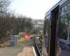
Rail Station
223 meters
Single line station at the end of the East Lancashire railway, handy for getting to P... Masons Mill
271 meters
Atkinson Street
212 meters
Rail Station
223 meters
Single line station at the end of the East Lancashire railway, handy for getting to P... Masons Mill
271 meters
 Colne
298 meters
This was a good station for departure, with a long platform for the branch line servi... Boundary Mill Entrance
491 meters
Princess Street
496 meters
Vivary Way
563 meters
Alkincoats Road
629 meters
Phillips Lane
667 meters
opp Carlton Court
729 meters
St Johns Church
755 meters
Always putting on great events for everyone. Handmade light up parade was just ine o... Tennyson Road
871 meters
Boundary Retail Park
881 meters
Colne More Fisher School
943 meters
Windy Bank Top
968 meters
The Locks
976 meters
It's a nice flat complex but not much to see if you don't live here or visit here.
Colne
298 meters
This was a good station for departure, with a long platform for the branch line servi... Boundary Mill Entrance
491 meters
Princess Street
496 meters
Vivary Way
563 meters
Alkincoats Road
629 meters
Phillips Lane
667 meters
opp Carlton Court
729 meters
St Johns Church
755 meters
Always putting on great events for everyone. Handmade light up parade was just ine o... Tennyson Road
871 meters
Boundary Retail Park
881 meters
Colne More Fisher School
943 meters
Windy Bank Top
968 meters
The Locks
976 meters
It's a nice flat complex but not much to see if you don't live here or visit here.to add The Sidings map to your website;

We use cookies and other tracking technologies to improve your browsing experience on our website, to show you personalized content and targeted ads, to analyze our website traffic, and to understand where our visitors are coming from. Privacy Policy
