


 West Street
282 meters
Coppice Side
366 meters
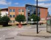
Greenbank Leisure
369 meters
Good local fitness centre, sure could do with some improvements, but let's support it... Gresley Common
397 meters
West Street
282 meters
Coppice Side
366 meters
Greenbank Leisure
369 meters
Good local fitness centre, sure could do with some improvements, but let's support it... Gresley Common
397 meters
 Swadlincote
495 meters
Main bus station for swadlincote, buses to derby, Burton, Ashby-de-la-zouch and East ...
Swadlincote
495 meters
Main bus station for swadlincote, buses to derby, Burton, Ashby-de-la-zouch and East ... Swadlincote Police Station
531 meters
I don’t even know where to start regarding this police Servises a specially the neigh... Civic Way
586 meters
Swadlincote Police Station
531 meters
I don’t even know where to start regarding this police Servises a specially the neigh... Civic Way
586 meters
 Ski Centre
588 meters
Took my 10 year old daughter & we had a great time. The staff were great & ve... Brunel Healthcare
755 meters
I used to take vitaminstore energy release as they are fantastic value and did give m... Brunel Healthcare
762 meters
I used to take vitaminstore energy release as they are fantastic value and did give m... Belmont Primary School
839 meters
Chiltern Road
857 meters
Railway Inn
945 meters
Came to the pub today with the wife and kids and had some food. The staff were very h... Springfield School (adj)
990 meters
Best school ever !Very inclusive school and very supportive staff and Headteacher.Be... Coronation Street
1 km
Pingle School
1 km
The school is great, i am currently going to this school i am a prefect and in my las...
Ski Centre
588 meters
Took my 10 year old daughter & we had a great time. The staff were great & ve... Brunel Healthcare
755 meters
I used to take vitaminstore energy release as they are fantastic value and did give m... Brunel Healthcare
762 meters
I used to take vitaminstore energy release as they are fantastic value and did give m... Belmont Primary School
839 meters
Chiltern Road
857 meters
Railway Inn
945 meters
Came to the pub today with the wife and kids and had some food. The staff were very h... Springfield School (adj)
990 meters
Best school ever !Very inclusive school and very supportive staff and Headteacher.Be... Coronation Street
1 km
Pingle School
1 km
The school is great, i am currently going to this school i am a prefect and in my las...to add Highfield Street map to your website;

We use cookies and other tracking technologies to improve your browsing experience on our website, to show you personalized content and targeted ads, to analyze our website traffic, and to understand where our visitors are coming from. Privacy Policy
