


 Saul Way
292 meters
Church Street
453 meters
The Central Bar
474 meters
I've been drinking in the central a long time, Gerard and Linda are brilliant hosts, ...
Saul Way
292 meters
Church Street
453 meters
The Central Bar
474 meters
I've been drinking in the central a long time, Gerard and Linda are brilliant hosts, ...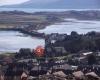 Downpatrick
503 meters
Our Lady & St Patrick's School
628 meters
John Street
720 meters
Downpatrick
503 meters
Our Lady & St Patrick's School
628 meters
John Street
720 meters
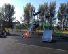 Knocknashinna Playground
728 meters
Heatons
782 meters
Great clothes shop love shopping in here for the grandchildren .. great choice to cho...
Knocknashinna Playground
728 meters
Heatons
782 meters
Great clothes shop love shopping in here for the grandchildren .. great choice to cho...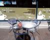 The Coffee Station
793 meters
Ardglass Road Junction
901 meters
The Coffee Station
793 meters
Ardglass Road Junction
901 meters
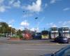 Downpatrick Bus Station
921 meters
Very nice bus station small cafe for drinks bus on time only £6 to Belfast St Mary's High School
938 meters
Eclipse Cinema
942 meters
Great experience. I went to watch the new Avatar in the recline ticket's booked earli... Demesne
982 meters
Downshire Hospital
1 km
Both I and my family have been treated here. It’s such a nice hospital - everyone is ... Cemetery
1 km
Downpatrick Bus Station
921 meters
Very nice bus station small cafe for drinks bus on time only £6 to Belfast St Mary's High School
938 meters
Eclipse Cinema
942 meters
Great experience. I went to watch the new Avatar in the recline ticket's booked earli... Demesne
982 meters
Downshire Hospital
1 km
Both I and my family have been treated here. It’s such a nice hospital - everyone is ... Cemetery
1 km
to add Lower Saul Road map to your website;

We use cookies and other tracking technologies to improve your browsing experience on our website, to show you personalized content and targeted ads, to analyze our website traffic, and to understand where our visitors are coming from. Privacy Policy
