 Shropshire Council
101 km
The area covered by Shropshire Council is 3,197 square kilometres, or 1,234 square mi...
Shropshire Council
101 km
The area covered by Shropshire Council is 3,197 square kilometres, or 1,234 square mi...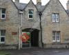 Thames Valley Police
108 km
Thames Valley Police
108 km
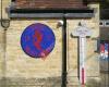
 Woodstock Town Hall
108 km
Terrible acoustics in the Mayor's Parlour (used for weddings and council meetings) th...
Woodstock Town Hall
108 km
Terrible acoustics in the Mayor's Parlour (used for weddings and council meetings) th... West Oxfordshire District Council
115 km
A good case study in the decline in liberal democracy. As a Canadian, the Clarkson's ...
West Oxfordshire District Council
115 km
A good case study in the decline in liberal democracy. As a Canadian, the Clarkson's ... Burford Balloons
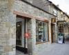
116 km
Burford Fire Station
116 km
Burford Balloons
116 km
Burford Fire Station
116 km
 Burford
116 km
Witney Police Station
116 km
Police station with a staffed front desk. When closed if you need assistance or summo...
Burford
116 km
Witney Police Station
116 km
Police station with a staffed front desk. When closed if you need assistance or summo... Burford School
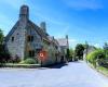
116 km
I have a daughter at the school and one who will attend in two years time.
An excepti...
Burford School
116 km
I have a daughter at the school and one who will attend in two years time.
An excepti...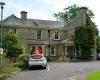 Mount House
117 km
West Oxfordshire District Council
117 km
Latest news from West Oxfordshire District Council and West Oxfordshire communities.
Mount House
117 km
West Oxfordshire District Council
117 km
Latest news from West Oxfordshire District Council and West Oxfordshire communities.to add Nottinghamshire County Council map to your website;

We use cookies and other tracking technologies to improve your browsing experience on our website, to show you personalized content and targeted ads, to analyze our website traffic, and to understand where our visitors are coming from. Privacy Policy