


 Queensway
282 meters
Junction Road
336 meters
Croft Place
416 meters
Croft Place
420 meters
Mildenhall
454 meters
Queensway
282 meters
Junction Road
336 meters
Croft Place
416 meters
Croft Place
420 meters
Mildenhall
454 meters
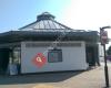 Tourist Information Centre
466 meters
Friendly staff. Nothing is a problem for them. Love how the staff go an extra mile St Marys Church
493 meters
This is a wonderful church next to the cathedral, very nice volunteer at the entrance... Health Centre
538 meters
Health Centre
538 meters
Health Centre
539 meters
Police Station
636 meters
Local and 101 number the same can't get an anawer. Has not got of an option for repor... Mildenhall Col Sheldrick Way Site
792 meters
Clare Close
848 meters
Bridge Farm Close
934 meters
Bridge Farm Close
941 meters
Tourist Information Centre
466 meters
Friendly staff. Nothing is a problem for them. Love how the staff go an extra mile St Marys Church
493 meters
This is a wonderful church next to the cathedral, very nice volunteer at the entrance... Health Centre
538 meters
Health Centre
538 meters
Health Centre
539 meters
Police Station
636 meters
Local and 101 number the same can't get an anawer. Has not got of an option for repor... Mildenhall Col Sheldrick Way Site
792 meters
Clare Close
848 meters
Bridge Farm Close
934 meters
Bridge Farm Close
941 meters
to add Folly Road map to your website;

We use cookies and other tracking technologies to improve your browsing experience on our website, to show you personalized content and targeted ads, to analyze our website traffic, and to understand where our visitors are coming from. Privacy Policy
