


 Leafield Way
287 meters
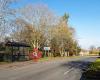
Bus Shelter
564 meters
The Estate
611 meters
Neston Crescent
684 meters
Village Hall
693 meters
Katherine Park
713 meters
Fuller Avenue
808 meters
Basil Hill Barracks
849 meters
Oathills
920 meters
Cotswold Family Centre
941 meters
Charlewood Road
1 km
West Park Road
1 km
Hatton Way
1 km
Poundmead
1 km
The Estate
1 km
Leafield Way
287 meters
Bus Shelter
564 meters
The Estate
611 meters
Neston Crescent
684 meters
Village Hall
693 meters
Katherine Park
713 meters
Fuller Avenue
808 meters
Basil Hill Barracks
849 meters
Oathills
920 meters
Cotswold Family Centre
941 meters
Charlewood Road
1 km
West Park Road
1 km
Hatton Way
1 km
Poundmead
1 km
The Estate
1 km
 Beechfield Road
1 km
This is an excellent bus stop. It has a four sided weather protection system, and gar... Elm Hayes
1 km
Beechfield Road
1 km
This is an excellent bus stop. It has a four sided weather protection system, and gar... Elm Hayes
1 km
to add Curlcroft Road map to your website;

We use cookies and other tracking technologies to improve your browsing experience on our website, to show you personalized content and targeted ads, to analyze our website traffic, and to understand where our visitors are coming from. Privacy Policy
