


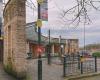
 Red Lion
93 meters
A very nice pub which was very busy on my visit. The bar itself was busy and vibrant ... Lime Tree Road
196 meters
Shortlands
380 meters
The Cliff
404 meters
Causeway Lane
495 meters
Old English
538 meters
Boat House
579 meters
Hurst Rise Middle
585 meters
Town Hall
689 meters
Bakewell Road (Stand A)
754 meters
Hazel Dene
768 meters
Artists Corner
778 meters
Red Lion
93 meters
A very nice pub which was very busy on my visit. The bar itself was busy and vibrant ... Lime Tree Road
196 meters
Shortlands
380 meters
The Cliff
404 meters
Causeway Lane
495 meters
Old English
538 meters
Boat House
579 meters
Hurst Rise Middle
585 meters
Town Hall
689 meters
Bakewell Road (Stand A)
754 meters
Hazel Dene
768 meters
Artists Corner
778 meters
 Interchange (Stand 3)
789 meters
Pertinent information, routes and times, clearly posted and updated.
Interchange (Stand 3)
789 meters
Pertinent information, routes and times, clearly posted and updated.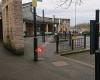 Matlock Bus Station
799 meters
Easy, well posted bus stops: Time tables and routes current and easy to find. Free ... High Tor Road
800 meters
Bakewell Road (Stand C)
816 meters
County Hall
919 meters
Hurst Farm / Lumsdale Crescent
944 meters
Matlock Bus Station
799 meters
Easy, well posted bus stops: Time tables and routes current and easy to find. Free ... High Tor Road
800 meters
Bakewell Road (Stand C)
816 meters
County Hall
919 meters
Hurst Farm / Lumsdale Crescent
944 meters
to add Church Street map to your website;

We use cookies and other tracking technologies to improve your browsing experience on our website, to show you personalized content and targeted ads, to analyze our website traffic, and to understand where our visitors are coming from. Privacy Policy
